 |
Cook Islands Meteorological Service Early Action Rainfall Watch The Early Action Rainfall Watch provides sector managers with a brief summary of recent rainfall patterns, particularly drought and the rainfall outlook for the coming months. |
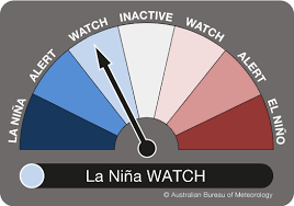 |
Current El Niño-Southern Oscillation (ENSO) status: The ENSO Outlook remains at La Niña Watch. There are some signs that a La Niña may form in the Pacific Ocean later in the year, however, there has yet to be a consistent/sustained signal to declare a La Niña event.
Cook Islands Meteorological Services along with regional climate partners will continue to closely monitor conditions in the tropical Pacific as well as model outlooks for further developments.
Status summary:
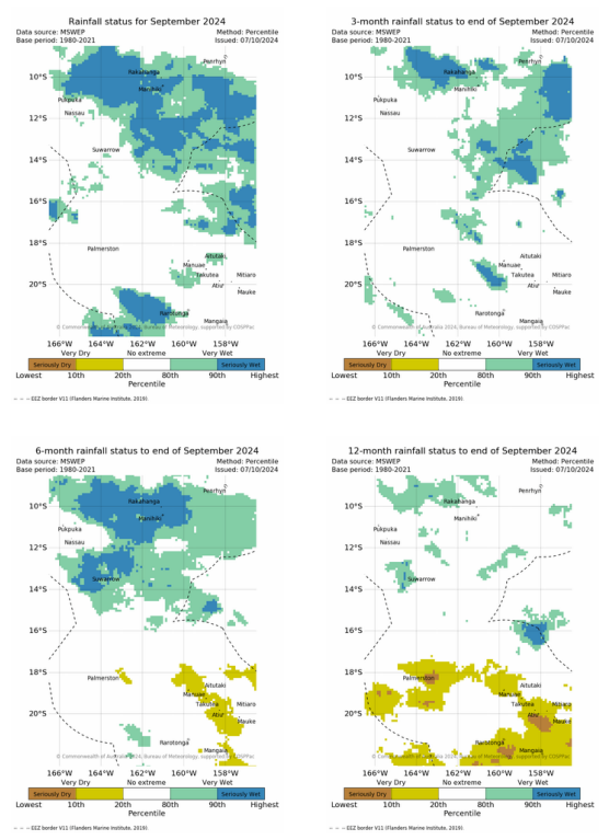
In September, seriously wet conditions were observed over Manihiki and very wet conditions were observed over Rakahanga, Pukapuka and Suwarrow.
The July to September period was very wet over Rakahanga and Manihiki.
From April to September, conditions were seriosuly wet over Suwarrow, Rakahanga and Manihiki. Very dry conditions over Aitutaki, Manuae, Takutea, Atiu and Mitiaro.
At the 12-month timescale, very dry conditions were observed over the whole of the southern Cooks
Outlook summary:
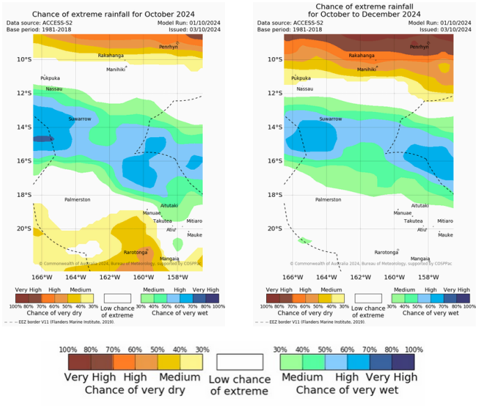
For October, there is a high chance of very dry conditions for Penrhyn and Rarotonga. A medium chance of very dry conditions for Rakahanga and Mangaia. A medium chance of very wet conditions for Nassau and Manuae. High chance of very wet conditions for Suwarrow.
For October to December 2024, there is a very high chance of very dry conditions for Penrhyn and a high chance of very dry conditions for Rakahanga and Manihiki.
Medium chance of very dry conditions for Pukapuka. A medium chance of Very Wet conditions for Suwarrow
See table/maps below for additional information. See status table below for potential impacts.
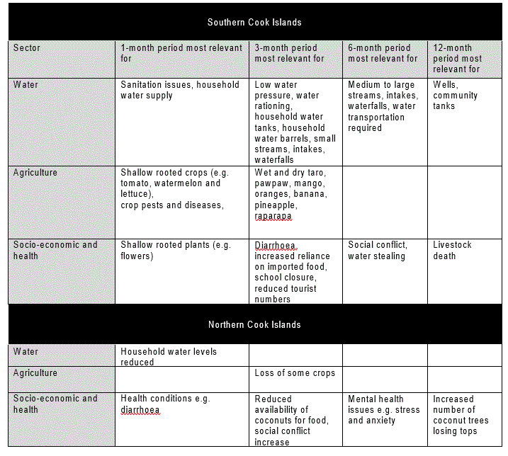
Impacts
After the specified period of below or above average rainfall, the following primary agricultural and hydrological variables and secondary socio-economic and health variables may be impacted. Note the periods are estimates only. Allow for uncertainty associated with island size, topography, and geology and soil type. Contact the relevant sector offices for further information on impacts.
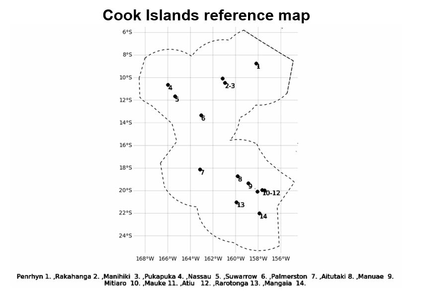
Rainfall monitoring for 12-month, 6-month, 3-month and the past month
About Rainfall Monitoring
The Standardized Precipitation Index (SPI) is used to assess rainfall status from the MSWEP dataset. MSWEP is a global precipitation product that combines rain gauges, satellite and reanalysis data to a 0.1° resolution. Meteorological Drought is defined as drought assessed by rainfall data only. A site is assigned 'No Alert' when rainfall has been near normal for the period(s) in question. The 3-, 6- and 12-month timescales can accurately predict drought, whereas 1-month status is an approximation only. This is because it is difficult to assess drought at this timescale.
Extreme Rainfall Outlooks
Rainfall Outlooks for October 2024, and October to December 2024
About Rainfall Outlook
Seasonal outlooks have been produced using the Australian Bureau of Meteorology ACCESS-S model http://www.bom.gov.au/climate/ahead/about/model/access.shtml. The outlook provides an indication of total one and three-month rainfall, not how intense the rain may be in any one event, nor how it may vary within the three months. A station is assigned 'No Alert' when near normal rainfall is favoured or there are equal chances of below normal, normal and above normal rainfall.
Contact the Cook Islands Meteorological Service for further information
The Director, Cook Islands Meteorological Service
P.O Box 127, Rarotonga, Cook Islands, Phone: 682 20603,
Website: http://www.met.gov.ck Email: mot.weather@cookislands.gov.ck